I had been thinking about hiding a multi-county hide for quite some time (but I had to win a hunt first). I had noted that Santa Barbara, San Luis Obispo, Kern, Ventura and Los Angeles counties were all in the greater Mt Pinos area. I had also wanted to hide a T on Cuyama Peak. With this in mind I started looking for locations. I settled on a plan to have the hunters travel in a circle, coming up Hwy 33 and returning on I-5.
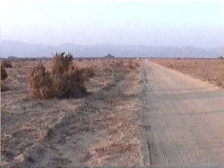
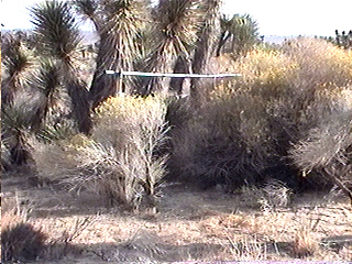
KG6KZF (David) and myself headed out mid afternoon on Friday to hide T1 & T3. We arrived at Cuyama Peak (south of Hwy 166 and west of Hwy 33 and in Santa Barbara county) about 5 PM. What we didn't know was that Mr. Murphy had tagged along. We found a spot on the west side and about 100 feet or so below the peak (where an old forest lookout remains) to hide the 4 watt T1. This might shield the direct signal from Mt. Pinos. After working our way though the brush that had fish-hook like leaves and grabbed everything (rope, coax, shirts, pants, etc), we pointed the 11-element beam toward the starting point and Reyes Peak. The beam had been recently acquired from a friend that was moving and the beam had been on his tower for several years. The idea was to have a good signal at the starting point and have a bounce off Reyes Peak for those hearing the signal on Mt. Pinos.
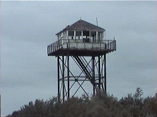 Lookout on Cuyama Peak | 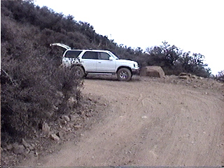 On the road at the last switch-back before the peak |
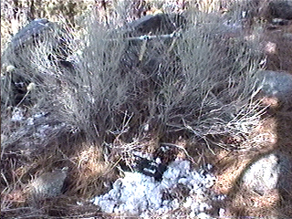
The beam was in place but the T didn't turn on. OK, take the T back to the car through the brush that grabs everything. The problem was a broken battery ground wire. It was repaired and taken back to the beam. We tested the setup. Hmmm, high SWR. I guess the beam had corroded from being on his tower more than I thought. We could key the Palos Verdes repeater using a hand held and rubber duck but couldn't key it with using the beam. Not a show stopper, we would just use the RJN "coat hanger" beam. This involved untying the 11-element, dragging it through the brush (that grabs everything) and dragging in the RJN beam. Once in place I found the matching section had become unsoldered from the driver element. Back through the brush to the car. Re-solder the matching section. Back through the grabbing brush. While tying the antenna into place I noticed the half of the reflecting element had broke off somewhere in the brush. Back to the car with the beam. Fortunately, we still had one more "coat hanger" beam left. Back through the brush. Tie the beam in place. Check the SWR. Key up Palos Verdes .This time everything worked. If all continued to go well, the newly installed timer would turn on the T the next morning. We left in the dark at 7:30.
 T-1 | 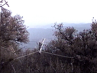 Looking toward the starting point & Reyes Peak |
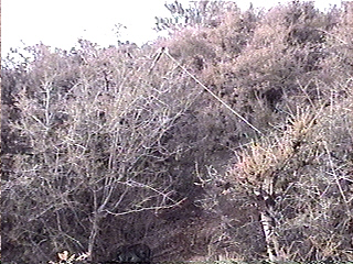
We did not have an exact site for the San Luis Obispo county T (T3) but I had a place in mind. We found a dirt road off of Foothill Rd (just south of Hwy 166 / Hwy 33 junction) that parallels the Cuyama River and hid the 50 mW T3 in a bush next to the dirt road. This T was left on as we wouldn't be back this way the next day.
 T-3 is in the bush | 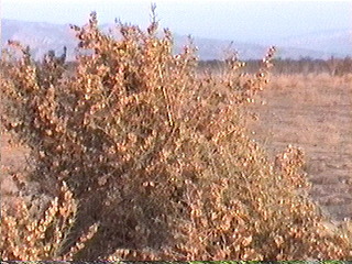 T-3 |
We arrived home at 11:30 PM to fix the coat hanger beam and to finish assembling T2.
On Saturday we left at 6:45 to hide the remaining Ts. First was T4 running 4 watts using a vertical "tape measure" 3-element beam. This T was located on Pine Canyon Rd, (south of Hwy 138, east of I-5) 4 miles east of Three Points. The antenna was pointed toward Tecuya Ridge (location of T6).
 T-4 |  Looking toward Fraizer Pk / Mt Pinos |
We found a maze of sandy roads north of Hwy 138 and hid T5 six miles north of the junction of Hwy 138 and Three Points Rd. T5 was running 4 watts into the hopefully repaired RJN coat hanger beam which was horizontal and pointed at Frazier Mtn.
 T-5 |
It was now 10 AM we instead of being on Mt Pinos we were getting gas at the Frazier Park exit. I was much relieved when I called JPI and found that T1 had started as planned and that it could be heard at the starting point. The next T was T2 which we hid on the south side of Pinos which is where the road is in Ventura county. There was still a dusting of snow from the night before so we collected some and piled it around the T. T2 was running 350 mW into a horizontal 3-element tape measure beam pointed at Cuyama Peak. The idea was to draw the hunters that found T1 over to Pinos where they would also hear T4. On the way to T4 they would hear T5. At T2 we could hear T1. On the way down we could hear T4 and T5.
 T-2 | 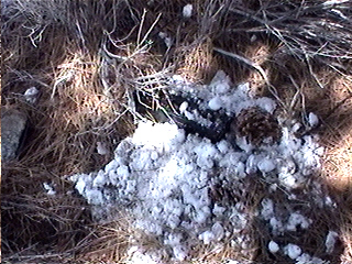 The "Snow T" |
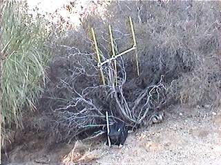
We had one T left. I had never been up the road on Tecuya Ridge (FR 9N19 - north of Mt Pinos) but on the map it looked like it might have a good view of the valley below. We found a place at about 6500 feet and hid the 50 mW T6 in a bush by the road. We could hear T2 and T4 from the ridge.
 T-6 is in the bush to the right of the car | 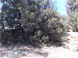 T-6 |
With all the Ts hid we went home.
On mid Sunday afternoon we left to collect the Ts. We found T1, 3, 4 and 6 to still be working. T2's battery and run down and was off the air. T5 could not be heard until you were near by. When I checked it at home it worked OK so I guess I must have been the antenna. I was working on Saturday afternoon when we went home.
Looking at the results, N6MI followed the route that we had intended and found T1 & T3. Proceeding toward T2 he found T6 but curiously never found the relatively near by T2 or the other Ts. JPI drove the loop backwards finding T4 first then T5, T6 and T2. Not sure why he didn't find T1 which could be heard from T2. I could not tell which way GQ/LAI came as they only found the middle Ts T2 and T6.
I did not think this hunt would be as difficult as it turned out to be. The most of the Ts were hid in places where there was only one road in the area. Only T5 would be difficult because of the many unmapped sandy roads. I used my GPS to find the T when I picked it up. I guest I'm a bit rusty at hiding these things as it's been 2 years since the last hide.
I'll try to do better next time. At least the hunters could hear the T at the starting point this time!
| XMTR | Location | County | Climate | Name |
| T1 | Cuyama Peak | Santa Barbara | Mountain | Main T |
| T2 | Mt Pinos | Ventura | Snow | Snow T |
| T3 | Cuyama River | San Luis Obispo | Valley | River T |
| T4 | Pine Canyon Rd | Los Angeles | Forest | Power Pole T |
| T5 | North of Hwy 138 | Kern | Desert | Sand Road T |
| T6 | Tecuya Ridge | Kern | Forest | Special T |
| WB6JPI | T4 | T5 | T6 | T2 |
| Time: | 1:55 PM | 2:55 PM | 5:05 PM | 6:12 PM |
| Miles: | 131.1 | 149.4 | 193.3 | 207.3 |
| N6MI / N6AIN | T1 | T3 | T6 | |
| Time: | 4:00 PM | 6:09 PM | 8:07 PM | |
| Miles: | 167.4 | 208.5 | 252.3 | |
| KF6GQ / KD6LAJ | T6 | T2 | ||
| Time: | 5:25 PM | 6:15 PM | ||
| Miles: | 172.5 | 183.7 | ||
| N6ZHZ / CYG | DNF | |||
Doug
WA6RJN