Meathead
All Day Transmitter Hunt
Hiders: Paul WB6HPW, Martin WB6YMI and Peter.
I wanted our hiding spot to be “vintage” – obscure dirt roads, confusing bounces, interesting locations. What I’m less enthusiastic about nowadays is the plethora of transmitters that one must find on hunts nowadays, so I decided to limit this hide to a single transmitter. In the 1980s my father WA6FAT SK and I hid at Sewart Mtn. in the Los Padres National Forest and I remembered it as being one of our best hides. At that time the starting point was Palos Verdes, and we put the transmitter down the south face of Sewart Mtn. so that one would get a good signal coming up I-5 and an inclination to veer off towards Fillmore with a nearly nonexistent signal on the entire route past Castaic practically all the way to the T.
My approach to scouting the spot was anything but vintage. First I did a Google search of thunter.org and found that Sewart Mtn. was used in a 1998 hunt, plus Alamo Mtn. was used a few times even recently. I wondered if I should abandon the location as being “overused.” Then by looking at online topographic maps, I happened to notice that there was a deep canyon on the north side of Sewart Mtn. pointing towards the northeast. Using Google Earth I “flew” into that canyon and found that from near the bottom was a near-perfect channel to the Tehachapis, in particular Covington Mtn., a finding Peter and I confirmed on a scouting trip the Monday before the hide. Unfortunately, a 2006 fire turned the lovely pine forests I remembered from the 1980s into a desert-like landscape that hadn’t significantly regrown in 8 years.
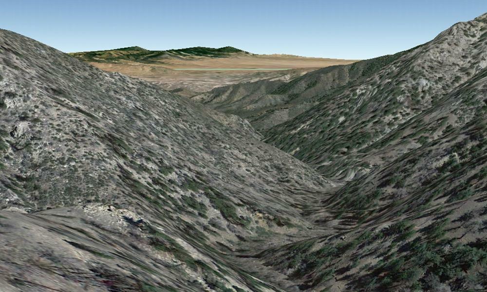
Google Earth view from the
hiding spot, looking to the east. Covington Mtn.
is the
right-most green peak in the distance. The faint green line in the Antelope Valley
is not a road, it’s the LA/Kern County boundary.
right-most green peak in the distance. The faint green line in the Antelope Valley
is not a road, it’s the LA/Kern County boundary.
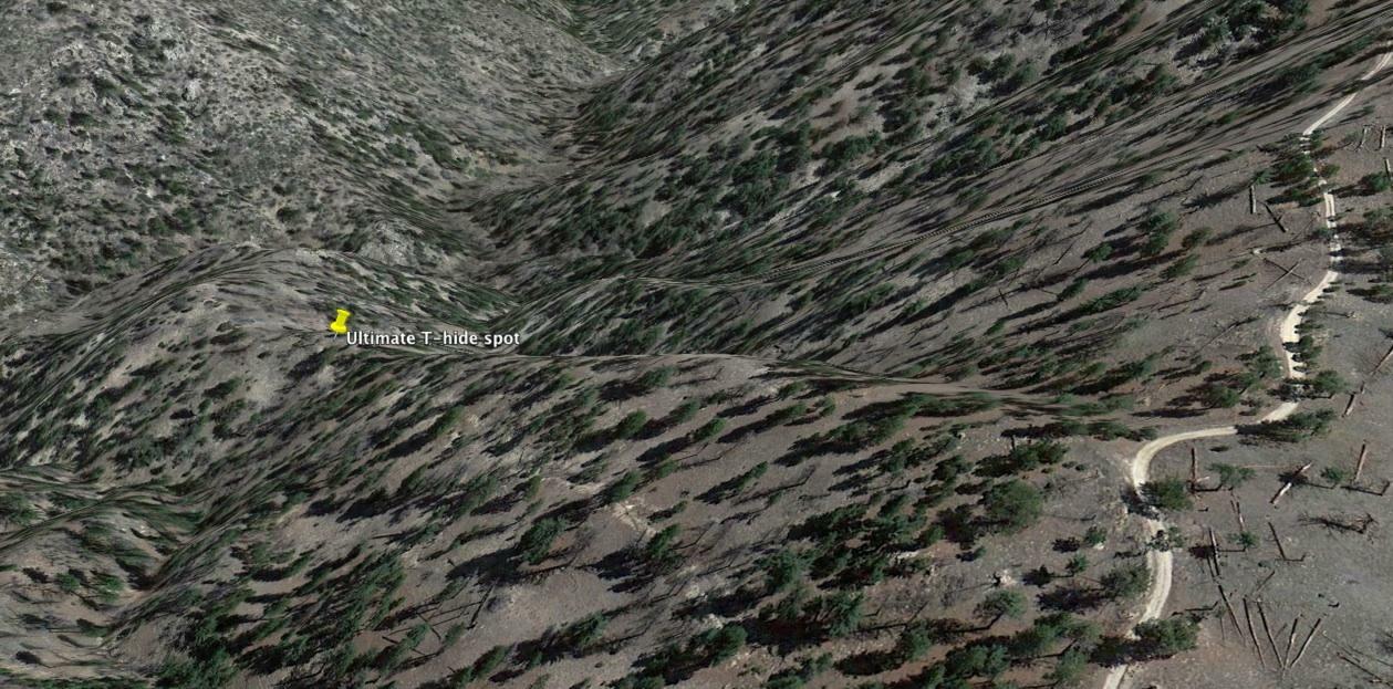
Another Google Earth view from
above and to the west of the T, showing the hiding spot,
the ridge down to it, and the road.
The “parking
area” was just past the prominent 90˚ right turn
in the road. We found that the faint path at
the bottom center of this
view was not very useful for access to the T, it was “easier” just to hike stright down the ridge.
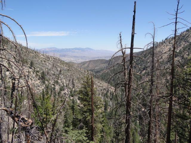
Photograph taken from the hiding spot (note the similarity to the first Google Earth image)
So we thought that we could point a beam at Covington Mtn. and people would spend a lot of time wandering around the Tehachapis, 50 miles from the transmitter. What’s interesting about this spot is
.There’s a direct shot to Covington Mtn. but almost nowhere else
.Covington Mtn. is a very prominent peak, visible from just about everywhere in the Antelope Valley including Cajon Pass
.There are no public roads that take you anywhere near the summit of Covington Mtn. so you can’t drive to the top and get a really definitive heading. The only high roads in the area are on the north side of the ridge (Tehachapi Mountain Park), 1000+ feet below the ridgeline.
.You don’t even have a view from I-5 to the hiding spot, there’s a lower ridge blocking the view. So even when you were on I-5, I thought that hiders would have no particular reason to expect that the transmitter was in the direction of Mt. Sewart, although it seemed that hunters in general did not experience this difficulty
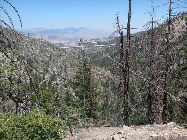
Beam pointed at Covington Mtn. (photo credit: Peter)
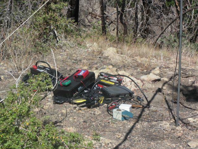
Transmitter, tape deck, inverter, battery, watt meter... (photo credit: Peter)
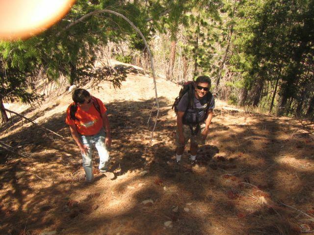
The hike back up the slope (one of many over the weekend…) (photo credit: Peter)
We parked at the top of the ridge right where one would hike down to the T… and waited. Most if not all hunters were initially “duped” into spending some time in the Tehachapis, particularly around the windmills. The first hunters to arrive were Bob and Kathy Miller N6ZHZ & KD6CYG at 4:20 pm with 163 miles. They were fully decked out in “vintage” attire, Bob in (appropriately enough) a Bob’s Big Boy outfit and Kathy in a 1970s flower child outfit complete with Love Beads.
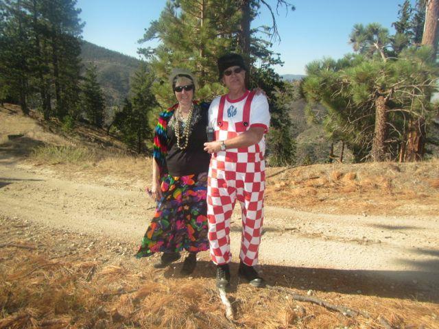
Bob and Kathy Miller N6ZHZ and KD6CYG
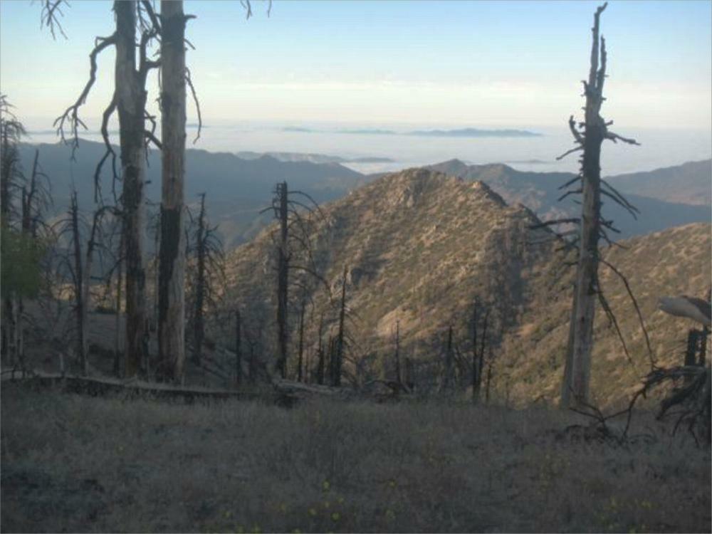
Great views from the ridge
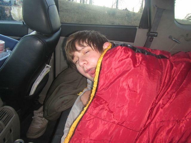
By the time Scott and Glenn left it was already 10 pm so we decided not to try to haul the rest of the equipment uphill, pack up and drive home that night. We had a cool, pleasant campout on the ridge (Martin and I at a spot with a commanding view to the south, Peter in the Cherokee). The next morning I completed the arduous task of hauling the 57 pound 12V marine battery up the slope. We had an uneventful ride back home, arriving at noon Sunday
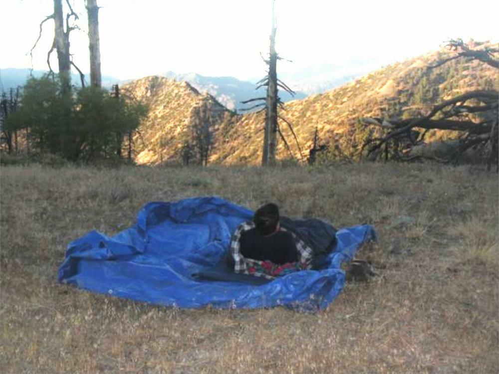
Morning after photos.
view was not very useful for access to the T, it was “easier” just to hike stright down the ridge.
Photograph taken from the hiding spot (note the similarity to the first Google Earth image)
So we thought that we could point a beam at Covington Mtn. and people would spend a lot of time wandering around the Tehachapis, 50 miles from the transmitter. What’s interesting about this spot is
.There’s a direct shot to Covington Mtn. but almost nowhere else
.Covington Mtn. is a very prominent peak, visible from just about everywhere in the Antelope Valley including Cajon Pass
.There are no public roads that take you anywhere near the summit of Covington Mtn. so you can’t drive to the top and get a really definitive heading. The only high roads in the area are on the north side of the ridge (Tehachapi Mountain Park), 1000+ feet below the ridgeline.
.You don’t even have a view from I-5 to the hiding spot, there’s a lower ridge blocking the view. So even when you were on I-5, I thought that hiders would have no particular reason to expect that the transmitter was in the direction of Mt. Sewart, although it seemed that hunters in general did not experience this difficulty
I was surprised to learn after the
hunt that the bearing from Cajon Pass wasn’t 310˚ or
so (which would be toward Covington Mtn.) but more
like 340˚. I still can’t figure out why the
bearing would be so far east, there’s nothing in
particular out that way to bounce a signal off
of. While driving around waiting for hunters to
arrive I found that where there was no direct signal
to the T, the signal pointed not to Covington Mtn. but
rather somewhat to the south of it; at night I found
in that direction was the blinking red lights of the
Tehachapi windmill farm, and sure enough many of the
hunters visited those windmills.
The problem with our location was that there was no road down into the canyon. One could hike 1/4 mile down the canyon slope from the Sewart Mtn. road to a spot that was close to optimal, but that location was 400 feet lower in elevation than the road. While there was sort of a path down the slope and it wasn’t so steep as to be hazardous, it would be quite a slog to haul equipment down to the spot and back up to the road. I wasn’t trying to make the hunt physically challenging nor was I trying to make the T more “hidden.” Nevertheless, this was the spot we needed for proper shielding to maximize the chance of getting the desired effect, so we decided to go ahead with that spot.
Now to the hunt. The most gratifying part for us was the turnout; I believe 9 teams started and 7 reached the “ending point” (note the quotes).
Brother Martin WB6YMI, son Peter and I drove up to Sewart Mtn. early Saturday morning in my not-very-vintage 2008 Grand Cherokee. We were planning on an 8 am start (per request from N6MI) but due to a few glitches we didn’t get on the air until after 9 am. The transmitter was a vintage 1978 Kenwood TR-7400A. Martin was trying to restore his Heathkit HW-20 to operating condition but couldn’t get the job done in time despite heroic efforts; maybe next hide. The antenna was a 11 element Yagi and the audio was sound effects from various T-hide cassette tapes, some dating back to the 1970s and some recorded recently, all played on a 1986 Teac auto-reversing tape deck. Originally we were planning on playing the tape deck output into a speaker, with a “taped mike” to get the audio into the Kenwood, but due to some glitches we wound up combining vintage and new technologies to get the audio into the Kenwood.
Beam pointed at Covington Mtn. (photo credit: Peter)
Transmitter, tape deck, inverter, battery, watt meter... (photo credit: Peter)
The hike back up the slope (one of many over the weekend…) (photo credit: Peter)
We parked at the top of the ridge right where one would hike down to the T… and waited. Most if not all hunters were initially “duped” into spending some time in the Tehachapis, particularly around the windmills. The first hunters to arrive were Bob and Kathy Miller N6ZHZ & KD6CYG at 4:20 pm with 163 miles. They were fully decked out in “vintage” attire, Bob in (appropriately enough) a Bob’s Big Boy outfit and Kathy in a 1970s flower child outfit complete with Love Beads.
Bob and Kathy Miller N6ZHZ and KD6CYG
Other hunters started arriving later
in the afternoon; by sunset only 2 teams had not
arrived. The problem was that the only safe
place to descend to the T was where we were parked,
and the signal wasn’t particularly strong there, in
fact my bearing from that spot was back towards
Tehachapi. In fact some people were sniffing on
the wrong side of the ridge. I wonder if hunters
would have stopped at that particular spot if we were
not parked there (there was a good campsite, hidden
from the “main” road, about a mile west of the T,
where we could have waited.)
I was fully prepared for people to drive around for a while and then tell me, “it’s right down that slope right here and I could hike down there but I wouldn’t be able to hike back up” - but no one did “complain” (as T-hunt rules require, I suppose). If they had I would have given them credit for the “find.” I think the hamburgers and other goodies at our location discouraged most people from looking too hard. Special thanks to Peter for trying to get everyone’s orders straight.
The first person to actually find the T was Doug WA6RJN at about 8:30 pm, followed by Scott N6MI and Glenn AB6PA about 9:00 pm. Doug’s mileage was 170 (compared to a minimum direct drive distance of 122 miles, taking advantage of all the diagonals across the Antelope Valley.) Scott declined to give his mileage but said that it was much more than 170. Moreover, Doug had a vintage antenna, used paper maps, etc. whereas Scott and Glenn didn’t claim any vintage credits so WA6RJN was declared the winner with N6ZHZ and KD6CYG earning “double honorable mention” for their vintage attire and for being the first ones to arrive in the area.
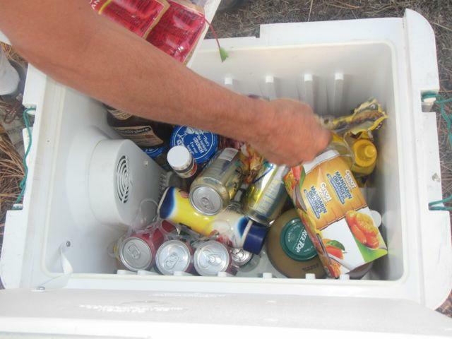
Plenty of goodies for everyone! (Photo credit: Peter)
I was fully prepared for people to drive around for a while and then tell me, “it’s right down that slope right here and I could hike down there but I wouldn’t be able to hike back up” - but no one did “complain” (as T-hunt rules require, I suppose). If they had I would have given them credit for the “find.” I think the hamburgers and other goodies at our location discouraged most people from looking too hard. Special thanks to Peter for trying to get everyone’s orders straight.
The first person to actually find the T was Doug WA6RJN at about 8:30 pm, followed by Scott N6MI and Glenn AB6PA about 9:00 pm. Doug’s mileage was 170 (compared to a minimum direct drive distance of 122 miles, taking advantage of all the diagonals across the Antelope Valley.) Scott declined to give his mileage but said that it was much more than 170. Moreover, Doug had a vintage antenna, used paper maps, etc. whereas Scott and Glenn didn’t claim any vintage credits so WA6RJN was declared the winner with N6ZHZ and KD6CYG earning “double honorable mention” for their vintage attire and for being the first ones to arrive in the area.
Plenty of goodies for everyone! (Photo credit: Peter)
Great views from the ridge
By the time Scott and Glenn left it was already 10 pm so we decided not to try to haul the rest of the equipment uphill, pack up and drive home that night. We had a cool, pleasant campout on the ridge (Martin and I at a spot with a commanding view to the south, Peter in the Cherokee). The next morning I completed the arduous task of hauling the 57 pound 12V marine battery up the slope. We had an uneventful ride back home, arriving at noon Sunday
I actually did like the idea of a
“theme” hunt and hope to do another “vintage” hide in
the future, with other themes after that.
Suggestions?
Paul Ronny WB6HPW
Paul Ronny WB6HPW
Jippy's Story